The History of the Charlestown Breachway
Mariners who visit Ocean House Marina, and those who keep their boats with us, have to navigate the shallow channels that wind through our saltwater pond complex. Known as both Charlestown Pond and Ninigret Pond (and sometimes as Pawaget Pond), this is the largest salt pond in Rhode Island, with a surface area of 2,900 acres.
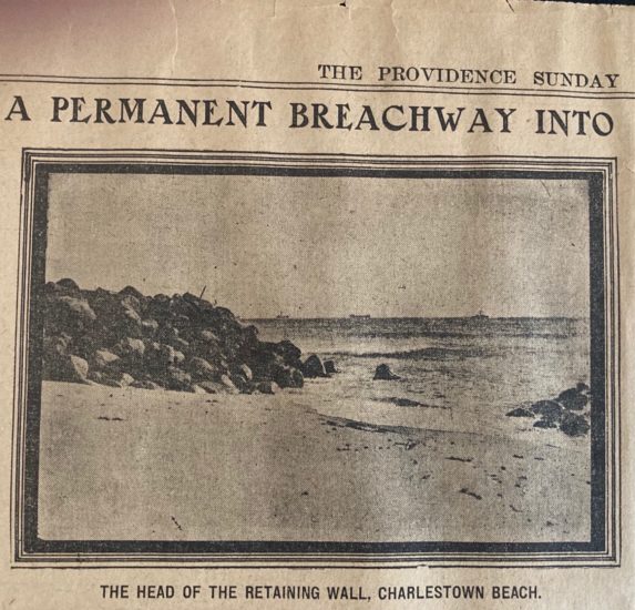
The pond is connected to the ocean at Block Island Sound by the Charlestown Breachway, a sixty-foot wide channel through the beach reinforced by twin 1400-foot long stone jetties. Once inside the breachway, boaters must follow the twisty channel, well-marked by green and red nuns and other warning buoys, to reach the more open parts of the pond. (See our navigational video here.) Ocean House Marina is on the northern shore of the pond, in what is known as Tautog Cove, near the historic old village of Cross Mills, where the Old Post Road (today’s U.S. 1) meets the old South County Trail (today’s Rte. 2/112).
In addition to providing easy access to the open ocean for boaters, the Charlestown Breachway serves the important role of allowing salt water to flow into Ninigret Pond, preventing brackish water and helping sustain the pond’s shellfish populations and marine estuaries.
Before Europeans settled in Charlestown (beginning around 1660) and for two centuries after, the entrance channel to Ninigret Pond from the ocean was narrow, shallow and often silted in due to normal storms and tides. In the late 19th century, as this area began to become popular as a summer tourist destination, the town fathers decided to try and open a permanent entrance to the pond, and managed to get the Rhode Island General Assembly to approve an expenditure of $1,000 (about $33,000 in today’s dollars) for construction of a standing breachway.
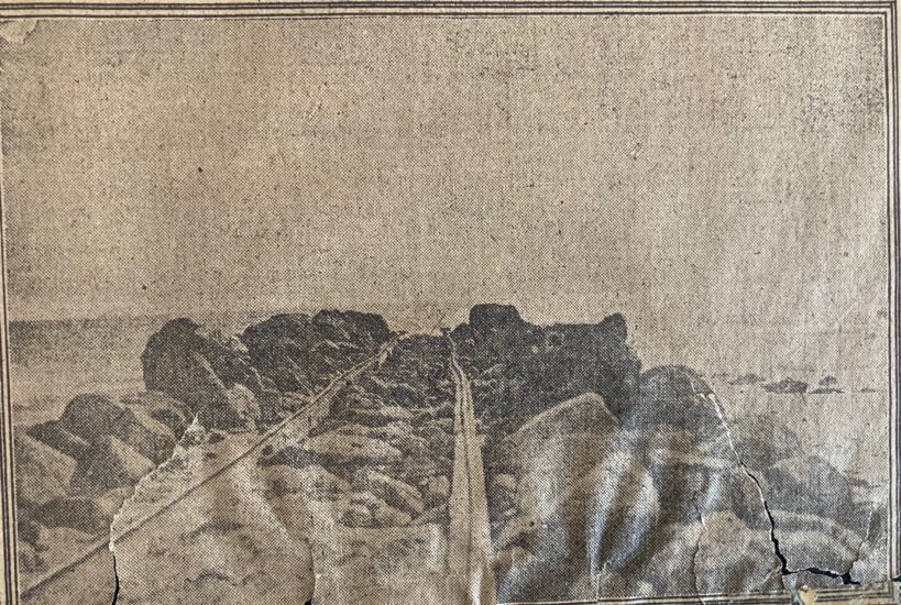
That attempt ended in failure, so the legislature tried again in 1904 and appropriated $5,000 ($152,000 today) to have the state engineer do the surveying, mapping and layout for the breachway. The plan called for twin jetties, 18 feet wide and 60 feet apart to extend into the sea beyond the low tide water mark. An additional $10,000 was later approved for construction of the west jetty, but that part of the project was not completed until years later.
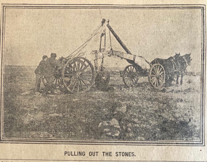
John Bristow of South Kingstown, who had overseen the construction of the Point Judith breakwater, got the contract. He found his source of rocks for the jetties in the Hill Pasture of Edgar Burdick’s farm on the north side of the pond, near a sandy road that led down to the beach. The contract called for payment of $1.75 per ton of rock.
Edgar Burdick’s farm (c. 1850) encompassed all of what is now Charlestown Beach Road, extending down to the ocean. Burdick himself was a stonemason. Where the Breachway Grill now stands was a gateway to the Burdick farm road and all who wished to travel to the breachway would need to seek his permission.
The project took several years to complete and was quite the logistical feat. First, the rocks had to be mined from beneath the pasture. This involved digging or drilling holes underneath the boulders, inserting hooks known as “Great Dawgs,” and hauling the boulders out with teams of horses.
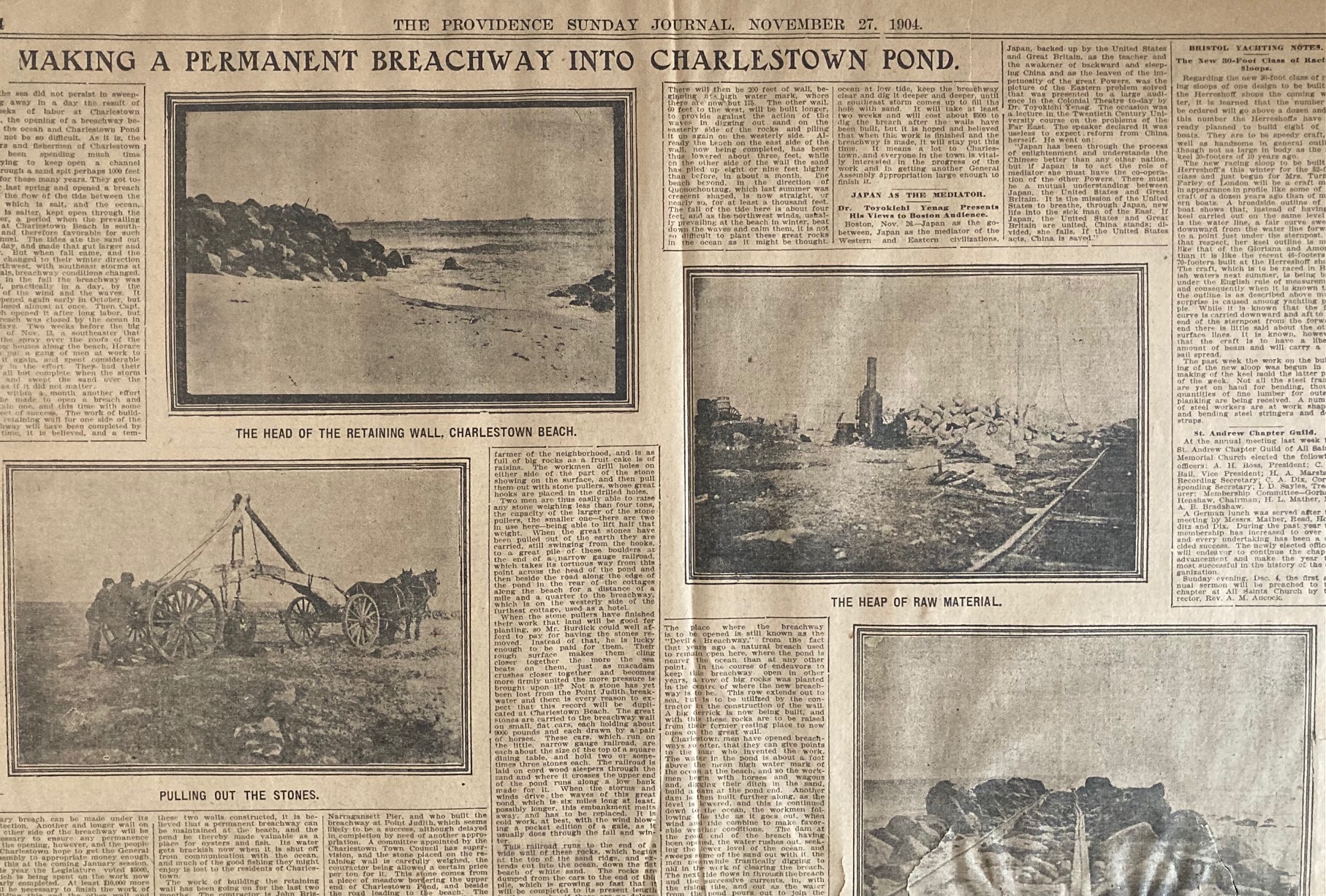
Once they had a suitable pile of boulders amassed, they built a narrow-gauge railroad laid on cordwood sleepers on a circuitous route from the head of the pond, around behind a row of summer beach cottages and back down the beach to the site of the breachway. The stones, each about 400 pounds, were carried on flatbed cars and stockpiled at the construction site.
The first iteration of the Breachway was completed around 1906. Within weeks, a storm blew past and sand and silt again filled the breachway until it could be dredged out again. During the early decades of the 20th century, fishermen often crossed the pond to the breachway and, finding it silted in, had to drag their boats down its length and, returning, drag their catch back down to the pond. Not the most optimal situation!
In 1951, the Rhode Island Division of Harbors and Rivers approved a contract for the rebuilding of the east jetty and construction of a new west jetty. Thanks to more modern construction equipment, the contractor was able to finish the job in four months, during the winter, despite a series of bad storms. The new and improved breachway was officially opened on April 7, 1952.
Today, the Charlestown Breachway separates the barrier beach along the Rhode Island shore. To the east is Charlestown Beach, RV campgrounds and the Ninigret Conservation area. To the west is East Beach and the South Shore Management Area.