Made in the Shade
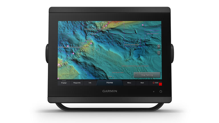
Have you seen the new 3-D shaded relief bottom charts? They’re “new” in the sense that they were first introduced in 2019, but are now pretty commonplace wherever captains and anglers are using Garmins.
The difference between these new colored, 3-D bottom charts and the old two-dimensional maps is like night and day.
All these new shaded relief maps utilize NOAA high-res bathymetric content from multibeam sonar surveys, which captures underwater structures and bottom patterns down to one centimeter! Added to that public data are sonar collections captured by the various companies marketing these new underwater plotters.
A single glance at the screen will demonstrate the amazing difference in detail that this new technology presents. The 3-D perspective along with the color shadings offers detailed views of the bottom: natural structures like rocks and reefs, as well as artificial structures such as wrecks, debris and anything else lying on the ocean floor.
Garmin combines the NOAA data base with its own Fishing Layer contours to give fishermen a visual advantage at seeing what lies beneath the waves.
If you’ve already got a Garmin unit on your boat, such as the popular EchoMap or GPSMap, you just need to purchase the g3 Vision card ($350-500) to get the charts for your part of the world. In addition to the new Relief Shading, you’ll get auto guidance, satellite imagery, aerial photography, 3D views, and more.
Once you see the amazing difference 3-D color shading can make, you’ll wonder how you got along without it all these years! Please contact Ocean House Marina for more information.